x
Wilderness Escapades
Facebook Twitter Instagram

Main menu

Skip to content
  • Appalachian Trail
    • AT Maine
    • AT New Hampshire
    • AT Vermont
    • AT Massachusetts
    • AT Conneticut
    • AT New York
    • AT New Jersey
    • AT Pennsylvannia
    • AT Maryland
    • AT West Virginia
    • AT Virginia
      • Northern
      • SNP
      • Central
      • Southern
    • AT North Carolina
    • AT Tennessee
    • AT Georgia
  • AT Hikes
  • Other Hikes
  • Guest Posts
  • Photo Challenge
  • Wildlife
    • Bears
    • Bobcat
    • Fox
    • Moose
  • About

Tag Archives: Hiking

River Crossing
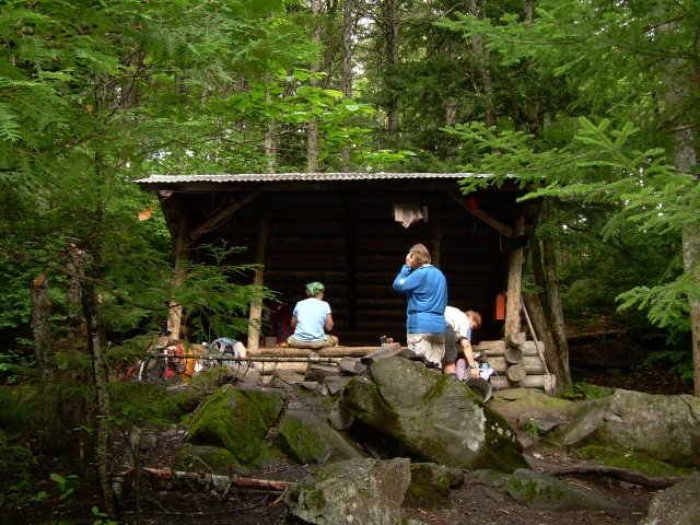
AT Maine

Logan Brook Lean-to to Stealth camp near Crawford Pond (9.4 miles)

Author admin Date March 31, 2012
We did this hike on August 12, 2008. There was a light drizzle as...
Tagged Appalachian Trail, Boardman Mountain, Crawford Pond, East Branch Lean-to, Hiking, Logan Brook Lean-to, Pleasant River |
Cooper Brook Falls Lean-to
AT Maine

Stealth camp near Crawford Pond to Jo-Mary Road (6 miles)

Author admin Date March 31, 2012
We did this hike on August 13, 2008. Before we broke camp, Dirigo went...
Tagged Appalachian Trail, Cooper Brook Falls Lean-to, Crawford Pond, Hiking, Jo-Mary Road |
Gas mask & final crutch
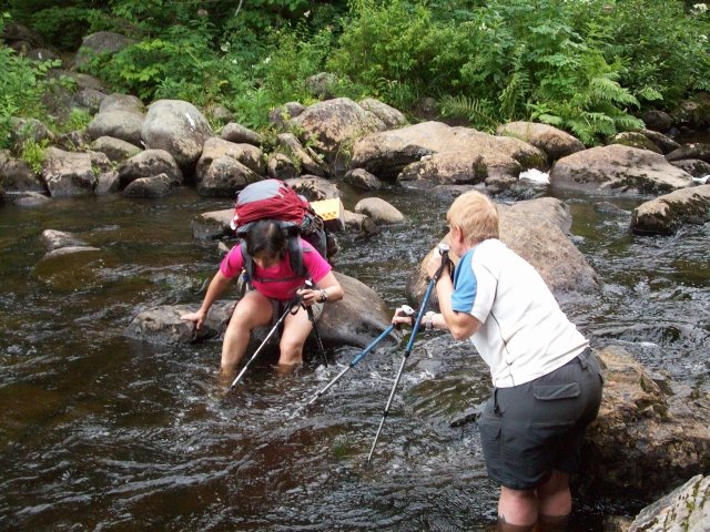
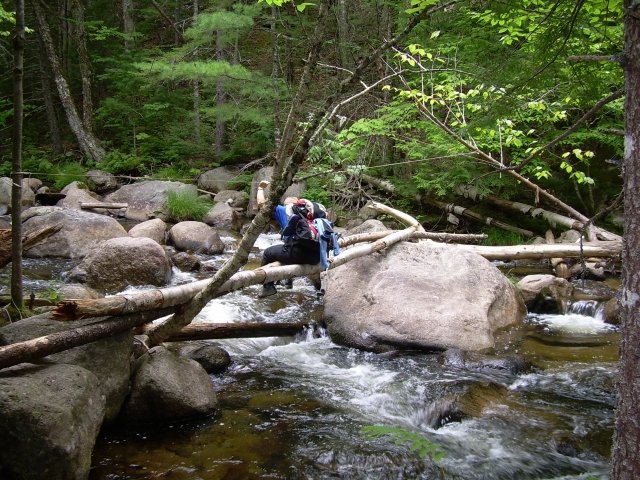
AT Maine

Wadleigh Stream Lean-to to Rainbow Stream Lean-to (8.6 miles)

Author admin Date March 31, 2012
We did this hike on August 15, 2008. We met our pilot Jim at...
Tagged Appalachian Trail, Hiking, Katahdin Air Service, Nahmakanta Lake, Nahmakanta Lake Camps, Nesuntabunt Mountain, Pollywog Stream, Rainbow Stream Lean-to, Wadleigh Stream Lean-to | 2 Comments |
Ascending Rainbow Ledges
AT Maine

Rainbow Stream Lean-to to Hurd Brook Lean-to (11.6 miles)

Author admin Date March 31, 2012
We did this hike on August 16, 2008. We broke camp just after 9...
Tagged Appalachian Trail, Hiking, Hurd Brook Lean-to, Rainbow Ledges, Rainbow Spring campsite, Rainbow Stream Lean-to |
Dragonfly is so happy to see her car!
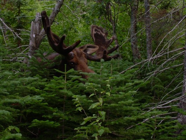
AT Maine, Moose

Abol Bridge Campground to Hurd Brook Lean-to (3.5 miles)

Author admin Date March 31, 2012
We have done this hike two times – once in 2007 as a day...
Tagged Abol Bridge Campground, Abol Ridge Runner, Appalachian Trail, Birches, Bluebearee, Hiking, Hurd Brook Lean-to, Katahdin, Katahdin Air Service, Moose, One Hundred Mile Wilderness, Roaring Brook campground |
Lower Nesowadnehunk Bridge
AT Maine

Katahdin Stream Campground to Abol Bridge (9.9 miles)

Author admin Date March 31, 2012
We did this hike on August 23, 2007 – 4 days after hiking Mt....
Tagged Abol Bridge, Appalachian Trail, Big Niagara, Hiking, Katahdin Stream Campground, Nesowadnehunk stream, Tote road, Tracy Pond |
Bullwinkle approaches
Moose, Other Hikes

Baxter Peak to Roaring Brook Campground (5.50 miles)

Author admin Date March 29, 2012
We did this hike on August 19, 2007. Saddle Trail We took the Saddle...
Tagged Baxter Peak, Chimney Pond Campground, Hiking, Hunt Trail, Moose, Roaring Brook campground, Saddle Trail | 1 Comment |
Summit of Mt. Katahdin
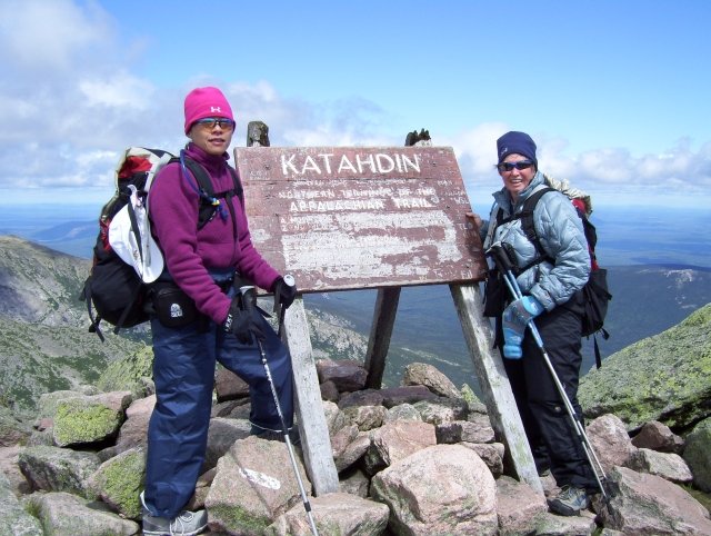
AT Maine

Katahdin Stream Campground to Mt. Katahdin (5.25 miles)

Author admin Date March 29, 2012
We did this hike on August 19, 2007. This was very early in our...
Tagged Appalachian Trail, Hiking, Katahdin Stream Campground, Knife Edge, Tablelands | 1 Comment |
SIMS and Gran
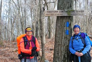
AT Virginia, Central

VA 624 to VA 620 (7.8 Miles)

Author admin Date January 15, 2012
There are two different ways you can get to the trail head on VA...
Tagged Appalachian Trail, Cove Mountain, Dragon's Tooth, Hiking, Pickle Branch shelter, Rawies Rest | 1 Comment |
AT Virginia, Central

VA 42 (Sinking Creek) to VA 621 (Craig Creek Road) (11.3 miles)

Author admin Date January 14, 2012
Sinking Creek is named that because the creek disappears underground near Hoges Chapel on...
Tagged Appalachian Trail, Craig Creek Road, Eastern Continental Divide, Hiking, HomePlace, Sarver Hollow shelter, Sinking Creek |
« Previous 1 2 3 Next »
Categories
  • Appalachian Trail
  • AT Conneticut
  • AT Georgia
  • AT Maine
  • AT Maryland
  • AT Massachusetts
  • AT New Hampshire
  • AT New Jersey
  • AT New York
  • AT North Carolina
  • AT Pennsylvannia
  • AT Tennessee
  • AT Virginia
  • Bears
  • Biking
  • Bobcat
  • Central
  • Fox
  • Grand Canyon 2010
  • Guest Posts
  • Moose
  • Northern
  • Other Hikes
  • Photo Challenge
  • SNP
  • Southern
  • Uncategorized
  • White Water Rafting
  • Wildlife
Latest Posts
  • Caratunk to Carrying Place Rd (8.5 Miles)
  • Happy First Birthday Michaux
  • Hightower to Woody Gap (12 miles)
  • Cheese Factory site to Unicoi Gap (3.6 Miles, May 14, 2015)
  • Neels Gap to HogPen Gap (6.5 Miles)
  • Tyringham to MA 2, Hoosic River (51 Miles)
  • Mt. Washington to Route 2 (34.6 Miles)
  • My name is Cullowhee
  • Housatonic River to Jug End Road (5.4 Miles)
  • Falls Village to Salisbury, CT (6.7 Miles)
Recent Comments
  • Brenda: Hello! My name is Brenda, and I am a senior at George Mason University in Fair
  • admin: Thank you Laura for allowing us to use your beautiful pictures for this article!
  • Laura: Happy birthday Michaux! I love the story of your name, and it was great to meet
  • admin: Mavin - Cullowhee has here own story at http://www.wildernessescapades.com/wp/20
  • admin: Thank you Mavis!
  • admin: Thanks Ann!
  • admin: Thank you Kylena
  • Mavis Warren: This needs to be done in a childrens ' book, I don't know of any child that wou
  • BoobOnARock: This just makes me so happy! Happy, happy birthday, Michaux!!!
  • admin: Thanks Kylena! It was definitely more work when hiking with our dogs but we are
Archives
  • August 2016
  • September 2015
  • June 2015
  • May 2015
  • September 2014
  • July 2014
  • June 2014
  • May 2014
  • April 2014
  • March 2014
  • February 2014
  • January 2014
  • December 2013
  • November 2013
  • October 2013
  • September 2013
  • August 2013
  • July 2013
  • June 2013
  • May 2013
  • April 2013
  • March 2013
  • January 2013
  • November 2012
  • October 2012
  • September 2012
  • August 2012
  • July 2012
  • June 2012
  • May 2012
  • April 2012
  • March 2012
  • January 2012
© Wilderness Escapades